Entry Points:

About Amargosa Valley
Amargosa Valley is a small unincorporated community on the California-Nevada border in the Amargosa Desert. It was formerly called Lathrop Wells. Creosote bushes are the dominant vegetation on the valley floor and there is inadequate water for farming. The soil is gravelly. The Funeral Mountains line the western horizon with Bat Mountain reaching out close to the town. Death Valley National Park lies both to the east and the west of the town, with the Devil's Hole unit on the east side, and the main section not far to the west. The Amargosa River, which is normally a dry wash, runs past on the southwest side of the town.
As the town is unincorporated, there are no official boundaries. Locally the surrounding valley is also called Amargosa Valley, although maps generally call it the Amargosa Desert. To the traveler the town appears to be centered near the border, but a number of other residences scattered around the valley probably also consider themselves part of Amargosa Valley.
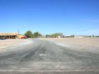
State Highway 373 begins at the state line and extends north to its junction with U.S. Highway 95. South of the state line, it is designated California Route 127, and heads southward to Death Valley Junction and eventually Baker, California, passing through many miles of barren desert. The other streets of the town run east-west branching off the highway. A few businesses are located along the highway, the most notable being the large inn and casino.
No population figure is available for Amargosa Valley, but it would be on the order of a couple hundred. The elevation is 2,167 feet.
For More Information:
See Wikipedia's Amargosa Valley article.
Street Index
|
a road a street Clark Street |
Diaz Drive Landers Street Lincoln Street |
Mineral Street Nye Street State Highway 373 |