Entry Points:

About Clark County
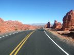
Occupying the southern tip of Nevada, Clark County is its most populous county. Shining with glitz, the Las Vegas metropolitan area fills Las Vegas Valley, in the center of the county. The Colorado River forms most of the eastern boundary. Hoover Dam, probably the most famous dam in the world, was built in the middle of that stretch of the river, forming Lake Mead behind it. In 1964, Lake Mead became the country's first National Recreation Area. Right next to Lake Mead, the Valley of Fire is a state park showing off an area of unique red rock formations.
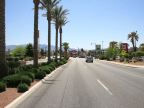
Sometimes referred to as "Sin City", due to its legalized gambling and other loose forms of entertainment, Las Vegas is an immensely busy tourist destination. Surprisingly, it was settled by Mormon pioneers in 1854, drawn by the artesian springs in the low part of the valley.
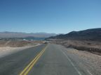
A desert climate covers all of Clark County except for forested areas high in the mountains. Creosote bushes cover the valley floors where urbanization has not moved in, and mountains are rocky and barren. To the east of Las Vegas stands Charleston Peak in the Spring Mountains, which reaches to 11,918 feet in elevation. Forests cover the top of the mountain.
Street Index
|
a dirt road a road a street Agnes Street Faught Circle |
Interstate 15 Moyes Circle Old Highway 91 Rivercliff Road Riverside Road |
Scrub Lane State Highway 40 Virgin River Whiterock Road |