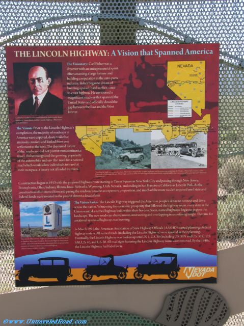
The Lincoln Highway: A Vision that Spanned America
The Visionary: Carl Fisher was a
dreamer with an enterpreneurial spirit.
After amassing a large fortune and
building a reputation in the auto-parts
industry, Fisher began to dream of
building a paved, hard-surface, coast-
to-coast highway. He envisioned a
agnificent roadway that spanned the
United States and official closed
the gap between the East and the West
forever.
The Vision: Prior to the Licoln Highway's
completion, the majority of roadways in
America were unpaved, dustry trails that
aimlessly rooked and kinked from one
settlement to the next. The disjointed nature
of the roadways did not permit transcontinental
travel. Fisher recognized the growing popularity
of the automobile and saw the need for a national
road which would allow individuals to tread at
their own pace, a luxury not afforded by trains.
Construction began in 1913 with the proposed highway route starting in Times Square in New Tork City and passing through New Jersey,
Pennsylvania, Ohio, Indiana, Illinois, Iowa, Nebraska, Wyoming, Utah, Nevada, and ending in San Francisco, California's Lincol Park. As the
construction effort moved forward, paving the roadway became an expensive proposition and much of the route was left unpaved until state and
federal funds were invested in the project almost a decade later.
The Vision Fades: The Lincoln Highway triggered the Amercan people's desire to connect and drive
across the nation. Witnessing the economic prosperity that followed the highway route, every state in the
Union wanted a named highway built within their boders. Soon, named highways began to pepper the
landscape. The new roadways shared routes, intersecting and overlapping in a confusing tangle. The time for
a national system of highways was looming.
In March 1925, the American Association of State Highway Officials (AASHO) started planning a federal
highway system. All named roads (including the Lincoln Highway) were ignored in their planning
Eventually the Lincoln Highway was broken up into U.S. 1. U.S. 30 (including U.S. 30N and U.S. 305), U.S.
530, U.S. 40, and U.S. 50. All road signs featuring the Lincol Highway name were removed. By the 1940s,
the Lincoln Highway had faded away.
Carl Fishwer was the creative mind behind the Indianapolis Motor
Speedway, Miami Beach, and the Lincoln Highway. (Illustration by Scott Fisher.)
Traveling the highway was an adventure. Most cars averaged only 18 miles per hour, and the entire trip would take 20-30 days. (Photo left: courtesy of the
University of Michigan Library. Photo right: courtesy of the Nevada Digital Collections Portal, koriginal held by the University of Nevada’s Special Collections
Department.)
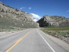
This stretch of the Lincoln Highway is known as the Loneliest Road
in America. After years of neglect, the Lincoln Highway Association
and the state of Nevada have made substantial efforts to preserve the
memory of America’s first transcontinental highway.
(Photo coutesy of Alvis Hendley.)