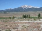
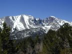
| Wheeler Peak, the crown jewel of Great Basin National Park, reaches 12,800 feet in elevation, seen here from the northeast. |
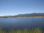
| Comins Lake lies in Steptoe Valley, south of Ely. |
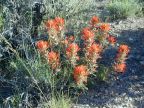
| Indian Paintbrush grows along Lexington Arch Road. |
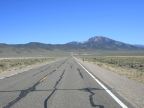
| U.S. Highway 93 approaches Lages Station at the feet of Becky Peak and the Schell Creek Mountain Range. |
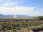
| A dust devil kicks up dust from the hardpan of Goshute Lake. Dust devils were blowing in this spot throughout our visit. |
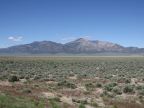
| Huesser Mountain rises above the west side of Steptoe Valley, just opposite from McGill. Its elevation is 9,411 feet. |
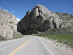
| State Highway 490 passes through Hercules Gap, a passage cut by water erosion through the southern tip of the Egan Mountains. |
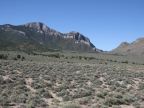
| Cliffs line the tops of the mountains of the Snake River Range, near U.S. Highway 6 & 50. |
| Lexington Arch in Great Basin National Park |
| Wheeler Peak |